
A leading GIS solutions provider
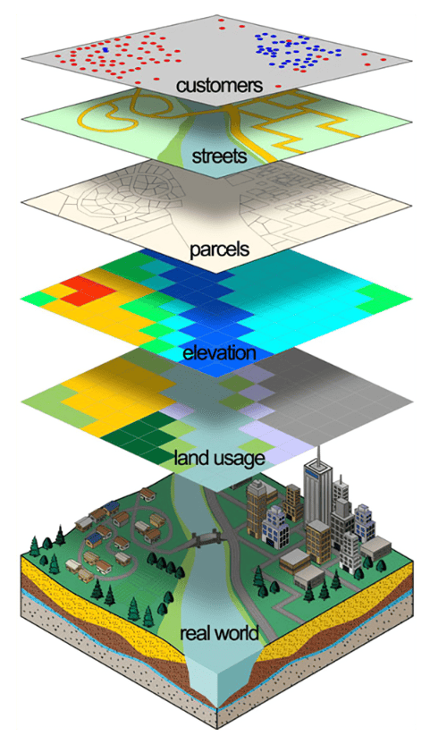
TC Merritts Surveyors employs Geographic Information Systems (GIS Solutions Provider) to link mapping with databases, enabling clients to examine, analyze and query their database visually and spatially. Through this technology, which allows for a degree of precision previously unachievable by traditional surveying methods, clients can optimize their capabilities in digital data archival storage, up-to-date management, and accurate implementation.
Our expertise in GIS includes specialized capabilities in conversion, geo database design, data management, analysis, and project support.
We support our clients in making informed decisions with high quality maps that provide accurate analysis and superior display of authentic and current GIS information, providing essential data, guidance, and supplemental materials for projects and programs of all types.
Our experienced GIS team captures and manages mapping data and attributes from multiple sources, including aerial photography and printed maps. The results, which can take multiple forms including dynamic ArcView maps with assigned attributes, support electronic business solutions and provide the basis for our report-based consultancy.
We specialize in the factual projection and presentation of reliable GIS data acquired from established data clearinghouses, using the most advanced software packages available to achieve unmatched digital cartographic exhibits that are accurate, reliable and precise.
For more information on TC Merritts’ GIS Solution Providers, contact us today.

Contact us to discuss your project requirements.
A leading GIS solutions provider
TC Merritts Surveyors employs Geographic Information Systems (GIS Solutions Provider) to link mapping with databases, enabling clients to examine, analyze and query their database visually and spatially. Through this technology, which allows for a degree of precision previously unachievable by traditional surveying methods, clients can optimize their capabilities in digital data archival storage, up-to-date management, and accurate implementation.
Our expertise in GIS includes specialized capabilities in conversion, geo database design, data management, analysis, and project support.
We support our clients in making informed decisions with high quality maps that provide accurate analysis and superior display of authentic and current GIS information, providing essential data, guidance, and supplemental materials for projects and programs of all types.
Our experienced GIS team captures and manages mapping data and attributes from multiple sources, including aerial photography and printed maps. The results, which can take multiple forms including dynamic ArcView maps with assigned attributes, support electronic business solutions and provide the basis for our report-based consultancy.
We specialize in the factual projection and presentation of reliable GIS data acquired from established data clearinghouses, using the most advanced software packages available to achieve unmatched digital cartographic exhibits that are accurate, reliable and precise.
For more information on TC Merritts’ GIS Solution Providers, contact us today.