3D Laser Scanning Services
In an effort to enhance urban planning and drainage systems, a 3D laser scan was conducted on a right-of-way in Bronxville, New York. Our RTC 360 laser scanner allowed us to provide valuable insights into the existing conditions of the urban space, serving as a foundation for future development and improvement projects.
3D Laser Scanning Services
The advanced 3D laser scanners used by TC Merritts Land Surveyors collect over 100 million points of data per setup, allowing for the capture and analysis of the size, shape, and location of real world objects in a given environment. Clients from homeowners to architects and engineers can easily view each scan station with the ease and familiarity of a display similar to Google Street View™.
- For Architects: 3D scanning captures as-built data of existing structures with high precision and detail.
- For Engineers: 3D scanning provides detailed surveys of infrastructure, such as bridges and roads, for maintenance and inspection.
- For Homeowners: 3D scanning generates floor plans that enables homeowners to visualize their home improvement projects such as renovations or additions.
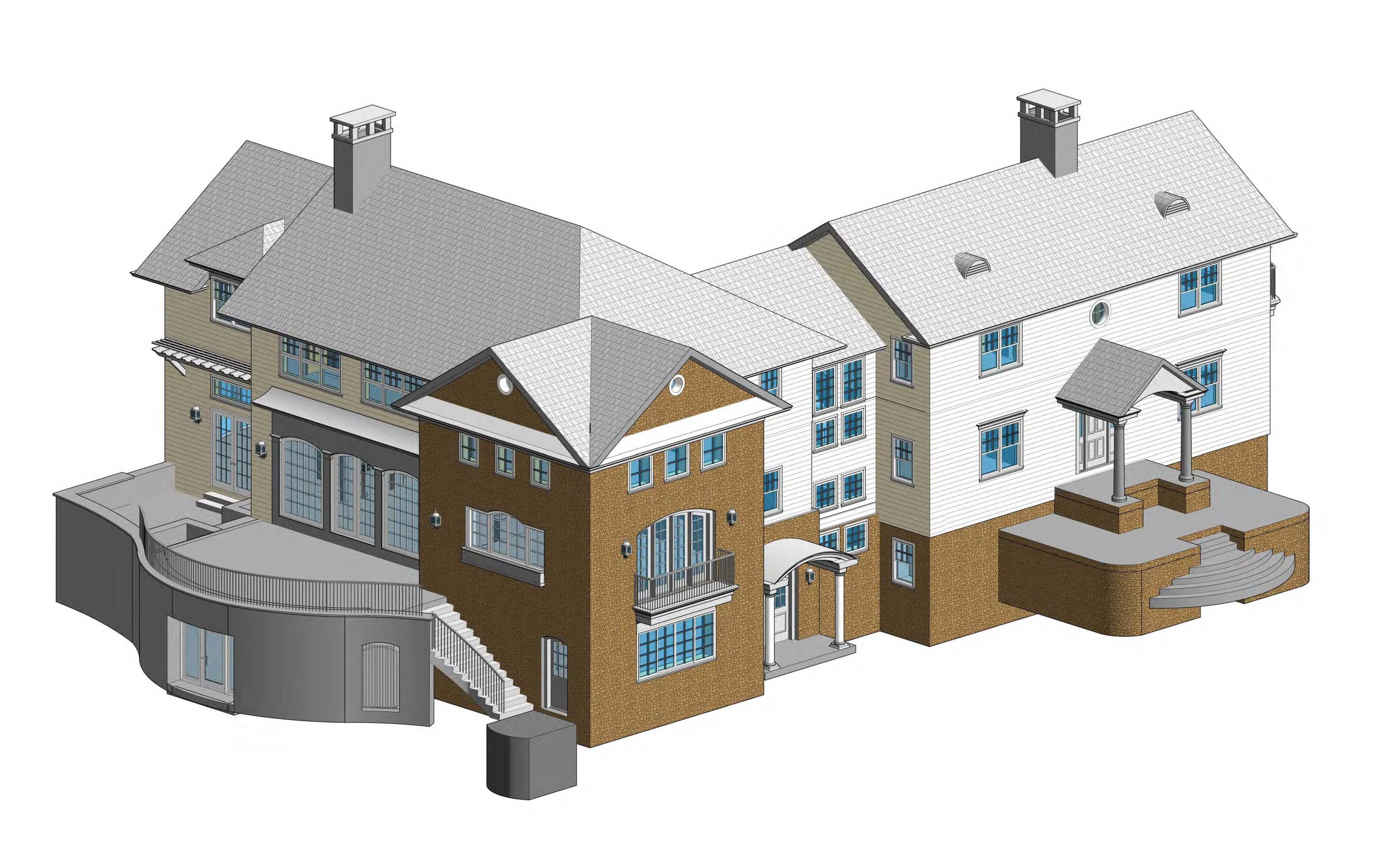
Real World-Based Models
The data collected by our 3D laser scanners can be registered into a unified point cloud and used to construct digital 3D models or 2D drawings that depict real-world conditions in their current states. This gives the client a large amount of precise information at the start of the project to facilitate decisionmaking process and save time and cost down the line.
Building Information Models (BIMs)
Our team can create highly detailed Building Information Models (BIMs) that provide a comprehensive and accurate digital representation of a building. Our clients use these models to plan and manage construction projects more effectively, reduce the risk of errors or delays, and save time and money.
Accurate representations of as-built conditions and physical objects
Due to their ability to provide detailed and accurate digital representations of physical objects and as-built conditions, the 3D CAD models generated from 3D laser scanning can be used for a wide range of applications.
2D diagrams for floor plans and elevations
Our team is also able to create 2D floor plans, sections, and elevations. These products are particularly useful for architects and designers who need to create detailed floor plans and exterior elevation plans for their projects.
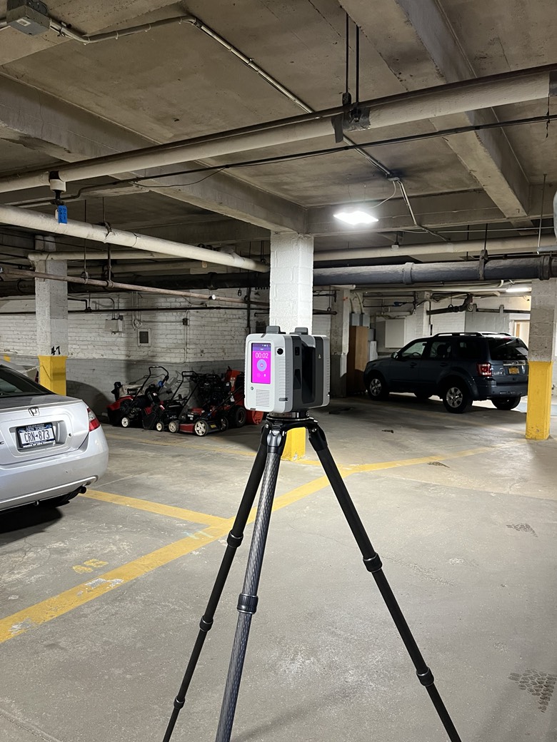
Advanced equipment
TC Merritts Land Surveyors uses the Leica RTC360 3D Laser Scanner to deliver accurate, reliable, and precise 3D representations of all objects and environments within a project.
Count on the TC Merritts Surveyors team to deliver the right 3D laser scanning solutions for your project. For more information, contact us today.
Architects and designers, we’ve got you covered too! Our 3D point cloud information enables us to create top-notch 2D floor plans, sections, and elevations. Perfectly tailored for your projects, these detailed plans will bring your visions to life.
Embrace the future with our transformative 3D point cloud information services. By providing you with accurate and comprehensive representations of physical spaces and objects, we empower your workflow, boosting efficiency and saving you both time and money. Whether you require BIMs, 3D CAD models, 2D floor plans, sections, elevations, or point cloud and panoramic images, our dedicated team is ready to deliver the perfect solution for your unique needs and requirements.
Step into a new era of precision and efficiency – partner with us today for unparalleled laser scanning services!
PAST JOBS
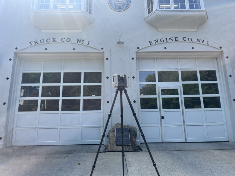
3D Laser Scanning Pelham’s Municipal Facilities