TC Merritts New, Cutting-Edge Laser Scanning!
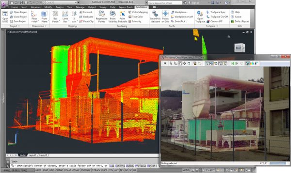
The MS60 is a cutting edge instrument that collects survey data points at a rate of 50,000 points per second. It has an effective range of 400’ to 500’. With several “scan” setups inside a room or of a building, a complete 3D model can be made of the existing conditions. These models are then used to create 2D civil or architectural drawings, 3D computer models, and final survey documents.
Laser scanning has revolutionized the field of land surveying and is fast becoming the preferred method of surveying for all kinds of architectural and construction projects. Laser scanning offers extreme accuracy, which results in precise reproductions of surveyed structures through 3D modeling and similar types of visual presentations.
3D laser scanning provides a better way to quickly and accurately capture as-built conditions for building documentation. Almost any project that requires accurate as-built information can benefit from 3D imaging.
Laser scanning technology enables us to help our clients plan and execute the most efficient projects by providing detailed spatial information to architects, design professionals, engineers, and builders, thereby allowing them to analyze all components of any facility or site. These capabilities help us make better decisions during every step of the project – from the planning stages through completion.
Advantages
- Measurement accuracy of ±2mm (depending on distance to measured object).
- Unobtrusive data capture methods.
- Rapid data capture of large volumes with increased accuracy.
- Measurements can be made quickly and easily when required without the need for return site visits.
- Shorter project times with a rapid turnaround of information.
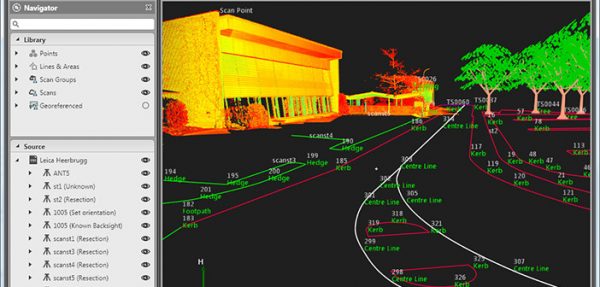
- Point clouds can be checked and measured using free viewing software, from any scan location.
- highly accurate drawings and models are some of the key benefits of the technology.
- Digital records – Post-processed point clouds can be directly exported to Autocad, Revit, NavisWorks, Microstation, Rhino, and other CAD platforms.